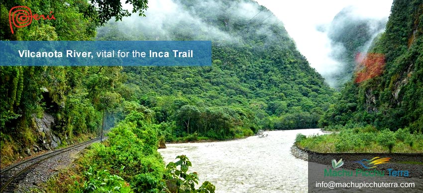
The Vilcanota River is one of the most important rivers for the populations of the past. Even today, it is still vital for crops. It is for this reason that we want to talk about this important water source that runs a total distance of 724 kilometers. It begins its flow at the border of Cusco and Puno and then crosses all the Cusco Andes and enters the high jungle of the same region. The continuous tributary of the Vilcanota River was vital for the Inca urban planners who built most of the Inca towns on the banks of this river that even reached Machu Picchu. For this reason, it has a special relationship with the Machu Picchu Inca Trail. Let’s see.
The Vilcanota river – origin
The Vilcanota River is one of the most important hydrographic sources located in southern Peru. This is because it has an extension that directly crosses Cusco. An important fact is that the Vilcanota River has the source of its tributary in the Abra or Paso de La Raya. This mountain range is a natural sign that separates the territories of Cusco and Puno. From these territories already in the altiplano, the waters begin to descend.
It is clear that like all rivers, it begins to acquire more water from various points such as the melting of the snow-capped mountains, the rains, the presence of some outlets of accumulated water, and other factors. The Vilcanota River will begin a long journey that will even reach Machu Picchu. Where it will not only change its name but will join a much larger river, the Ucayali River.

Abra la Raya – Beginning of the Vilcanota River
Vilcanota river extension
The extension of the Vilcanota River is 724 kilometers, from the source of its waters to the point where it flows into the Ucayali River. All this extension allows it to practically cross the main towns of Cusco or to put it another way, the cities with the highest rate of growth and population, are connected by this river.
This can not only be seen today but also in the Inca vestiges of the past. The Vilcanota River also connected ancient populations of the Tawantinsuyo, especially those that connected with Machu Picchu, since this is the place where it continues its course and also allows a beautiful view. This was the main reason why it is linked to the Inca Trail or Qhapac Ñam.
The Vilcanota River will cross the entire Cusco region. As we saw it will start in the pass of La Raya, and from this point, it will pass through a great part of the province of Canchis. Where we can highlight the points of Sicuani, Raqchi, and Tinta. In its route, it follows the Cusco Andes until it connects with Cusco. Let’s see the extension of the Vilcanota River through each province of Cusco.
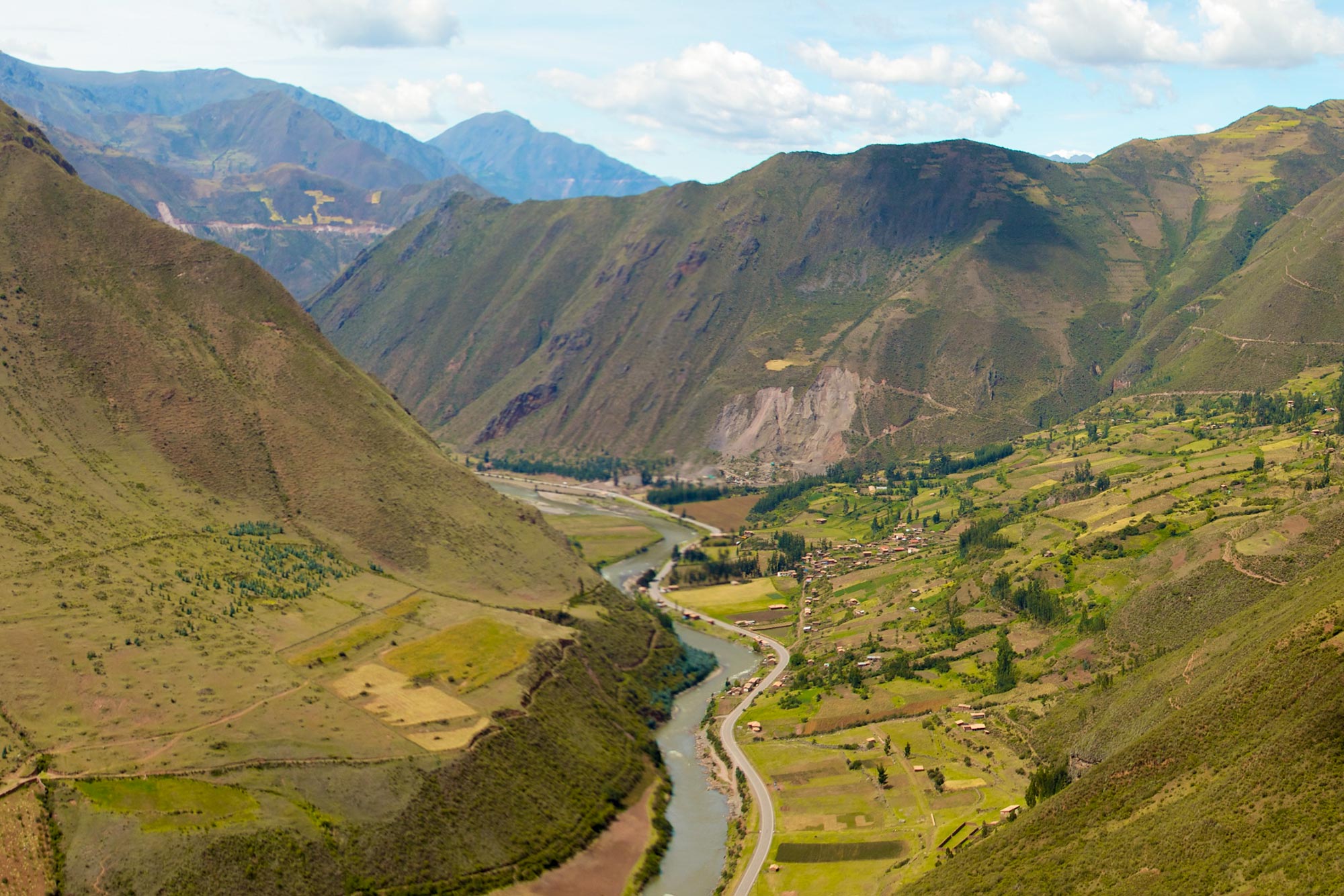
Vilcanota River flowing through the Sacred Valley
Main archaeological destinations connected by the Vilcanota River
The Vilcanota River is quite extensive as we saw in the previous section. It runs through a large part of the territory and also provides an excellent connection with other districts. Most of the districts mentioned in the table live in agriculture and similar activities. Highlighting the value of this river.
Both in the past and today, you can also note its importance for the people through which the Vilcanota River flows. In some cases, imposing ceremonial centers were built and even checkpoints that follow these waters during trekking routes on foot. Let’s get to know some archaeological sites that are connected thanks to this river.
Raqchi
It is an imposing Inca archaeological center, located very close to Sicuani and the district of Tinta. Currently, it belongs to the district of San Pedro, in the province of Canchis. The river passes near the terraces that probably served as retaining walls. In Raqchi you can find two types of constructions that have an intimate relationship with the Vilcanota River. The first is that it has the largest temple recorded by the Incas. Surely for one of the most important deities such as Wiracocha. The second is that they have 156 constructions of colcas or Inca food stores. In this sense, it can be said that the whole sector was related to agriculture and food storage.
Pikillaqta
It is a large archaeological park, belonging to one of the greatest pre-Inca cultures. It is believed that all of Pikillaqta was built by the Waris, long before the Inca expansion and domination. Although some theories position the Waris as direct predecessors of the Incas. The relationship of all the enclosure of Pikillaqta is also the proximity to the Vilcanota River. It is also important to note that from this point the river takes a detour to border Cusco and connects directly with territories that will connect the river with Ollantaytambo.
Ollantaytambo
In Ollantaytambo, you can also see the Vilcanota River very close. Before reaching these places you can see the passage through Taray and Pisac, points that show the beginning of the Sacred Valley of the Incas. The Vilcanota River also crosses this place that practically receives that name for the richness of its fertile land in the production of corn. The entire area up to Ollantaytambo was dedicated exclusively to agriculture. At present, this has not changed much and you can still see extensive cultivated lands that reach the entire province of Urubamba, where the Vilcanota River passes through before connecting with Ollantaytambo and then connecting with part of the Inca Trail.
Patallaqta o Llaqtapata
After passing through Ollantaytambo the waters of the Vilcanota River follow the route of the railroad or, rather, a road close to it. This, although it may not seem very credible, follows the Inca Trail to Machu Picchu in the distance. So from each archaeological site that follows, you can see part of the river. This river, surely was important for the agriculture of each of these places that are discovered along the Inca Trail. For example in Llaqtapata, you can find a large number of terraces. All of them are dedicated to agriculture.
Machu Picchu
Although from the top of the mountain, you can see the flow of the Vilcanota River, it highlights the impact it generated throughout this archaeological site. Especially when we talk about the Temple of the Moon of Huayna Picchu. This enclosure is not located in an area of high altitude but within the lush vegetation. To get there, you have to descend until you are practically next to the river. It is quite probable that the ancient populations used the waters of the place.
Huamanmarca
Huamanmarca is already located in the province of La Convención. It is said that this place was one of the nexus of the Inca enclosures that would begin to enter the Amazon. Within its constructions, some elements and representations of jungle animals can already be found. Precisely the Vilcanota river now called Urubamba is found bordering this place. Surely the next Inca constructions would follow part of the flow of the river until entering the low jungle. It is said that the expeditions to this place ceased because of the extensive resources needed to build these constructions.

Raqchi archaeological site
Relationship between the Inca Trail and the Vilcanota River
As we could see, the course of the river marked the route for some of the most important archaeological sites. These archaeological sites have an exclusive relationship with the presence of the Vilcanota River. It is for this reason that the Inca Roads had an exclusive relationship with the river. It is quite probable that some routes exclusively motivated the presence of some populations or at least massive sowing sites.
The Inca Trail or Qhapac Ñam, not only covered the route to Machu Picchu, a route that can be done today. It unified a large part of the entire continent located in South America. It even created roads that connected Ecuador with Chile or Argentina with Colombia. These great roads were very important to understand the strength of the Inca Empire.
The Vilcanota River, in this sense, played an important role, not only because thanks to its presence it was able to expand and improve crops in all the valleys along its course. But also because it began to be considered a deity and therefore, the inhabitants of the Tawantinsuyo kept a special affection for water as one of the main divinities.
The word Vilcanota is a Spanishization of the Quechua word “Willcamayu”. “Wilcamayu”, on the other hand, comes from two Quechua voices. The first one is “Willca” which has a connotation of divinity or sacred. While “Mayu”, makes a direct allusion to the river. In this sense, the translation could make a direct reference to “Sacred River”.
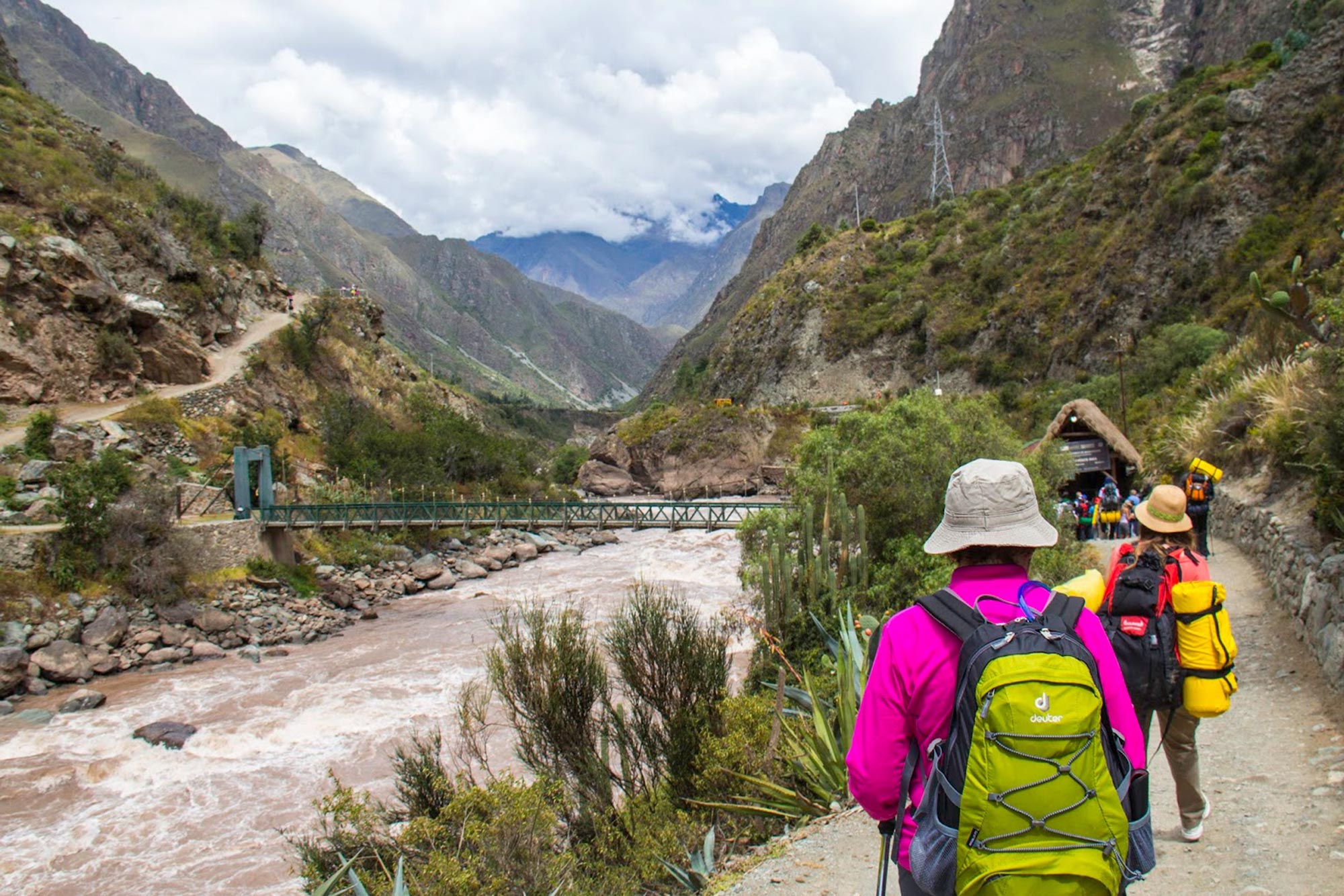
Vilcanota River on the Inca Trail Route – Piscacucho
Frequently asked questions about the Vilcanota river
During the Inca Trail can I get to see the Vilcanota River?
Yes, on any of the routes, whether it is the Inca Trail 4 or the 2-day route, it is possible to come across the Vilcanota River. We will have to cross it by the bridges that will connect with the campsites at the beginning of the route. Although at present the corresponding greeting to this deity is not made, it is important to do it. If only for a few moments to contemplate the beauty of its waters.
What is the total length of the Vilcanota River?
The Vilcanota River has an extension of more than 724 kilometers. This makes it cross several provinces and districts throughout Cusco. Besides being a water resource of great value for agriculture, as it was in the past.
What happens to the Vilcanota River during the rainy season?
Normally during the rainy season, there is an increase in water levels. This will cause some overflows and landslides. It is important to consult the state of the railroad tracks or the road if you are planning to make a trip.
Is it possible to do canoeing in the Vilcanota River?
Yes, normally, even in the dry season the waters of the Vilcanota River are abundant and have a strong flow. Of course, in some stretches this current will be stronger than others. That is why canoeing is only possible in some stretches of the entire expansion of the river. You can consult with your local guide or agency for some options for this activity.
From what point does the name of the Vilcanota River change to Urubamba?
It begins to be called the Urubamba River once it connects with this territory. Normally south of Cusco, it is called the Vilcanota River. Since it reaches the vicinity of Ollantaytambo, it is recognized as the Urubamba River. It is important to point out that it also receives a large amount of water when it reaches Urubamba.
By Inca Trail Machu Picchu - Last updated, 09-05-2024
Interested in the Inca Trail? Know more about Information Inca Trail!
- Inca Trail: prices and discounts
- Inca Trail hike as a therapy to heal body and soul
- What is it like to camp overnight on the Inca Trail?
- Online availability Inca Trail to Machu Picchu 2025
- Sustainability tips for the Inca Trail
- How to get to Ollantaytambo?