The Inca Trail is a route characterized by crossing rugged mountainous terrain. It goes through the mountain chain called Vilcanota and the Urubamba mountain range. It covers an area from 4,200 to 2,000 meters above sea level. The Incas had to adapt to this difficult geology to build their roads and, above all, to build the Inca city of Machu Picchu, one of the 7 wonders of the modern world.
The Inca Trail to Machu Picchu runs 39 kilometers until it reaches the Inca city. The Incas built these roads on an abrupt mountain territory where telluric movements are common because it is located on the ‘Batholith of Vilcabamba’. Despite this, thanks to hard and patient work, the Inca trail to Machu Picchu has remained unscathed until today. It is one of the best hiking trails on the planet.
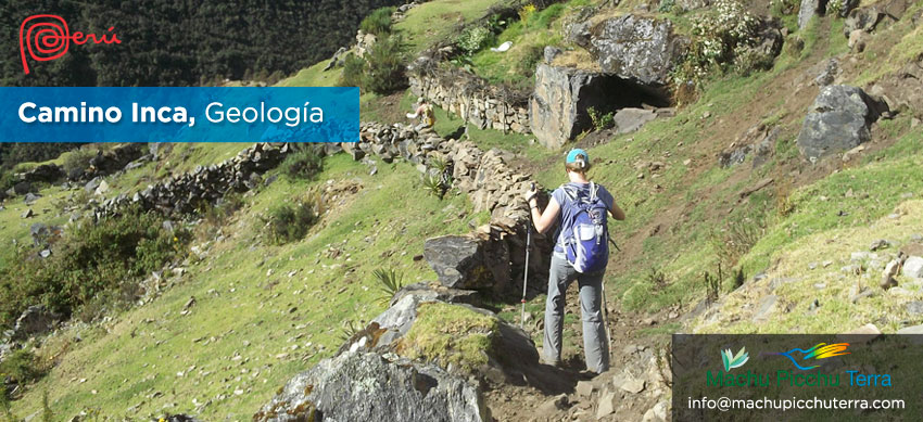
Geology of the Inca Trail
The ground on which this section of the Inca Trail was established was unstable due to its proximity to the ‘Batholito de Vilcabamba’. The origin of this geological fault is more than 250 million years old (Paleozoic period).
The Incas had to adapt to this difficult geography. Thus, to build the Inca roads, they excavated the earth in several layers until they were filled with stones and covered with grass and other rocks. In addition, they built gutters that eliminated the water accumulated with the rains.
Likewise, to avoid the slopes of the mountains, the Incas built stairways. The roads were perfectly adapted to the geography of each place. The section of the Inca Trail to Machu Picchu is winding and very resistant.
Geology in Machu Picchu
The Inca city of Machu Picchu is built on an outcrop of granite blocks and intrusive rocks from the Vilcabamba batholith.
The rocks found on the mountain belong to the Triassic age and there are also rocks from the Mesozoic and Cenozoic age. The most prominent rocks are igneous rocks formed by granites cut by geological faults.
The mountain on which Machu Picchu was built has a rocky outcrop that made it possible to obtain granite stones for the construction of its enclosures and temples. Granite is the most abundant rock. It has a white or gray color with the presence of quartz.
It should be noted that the entire Inca city was a great quarry. A sample of this is in the religious sector, just before entering the Temple of the 3 windows. The entire sector was occupied with this type of quarry and the Incas knew how to stabilize the terrain and the possible landslides with the construction of containment platforms.
Geological hazards on the Inca Trail
The Incas, before building the sacred city of Machu Picchu, stabilized the land. Then they made channels for the water to flow and later they just built the citadel. This made it possible to better resist the constant telluric movements since Machupicchu is located in a geological fault.
Due to the adaptation of the Inca constructions to the geography of the place, Machu Picchu has survived time. Today, there are few geological dangers that can be generated in the Inca city.
It is worth mentioning that during the rainy season, especially in January, February or March, stone falls can be generated from the highest mountains. This does pose a danger to visitors. That is why the Inca Trail authorities decided to keep the hiking route closed in February.
Recommendations to preserve the Inca Trail
The Inca Trail is a hiking route protected by the Peruvian State as it is a historical path with great cultural value.
To better preserve the Inca Trail, tourists are required to comply with certain regulations. For example, it is forbidden to damage stone paths. These were built by the Incas and taking care of them is everyone’s duty.
It is worth mentioning that the Inca roads, the qhapac ñan, are considered as Cultural Heritage of Humanity. They covered more than 30 thousand kilometers that include part of the current countries of Peru, Bolivia, Chile, Argentina, Ecuador and Colombia.
By Inca Trail Machu Picchu - Last updated, 22-08-2024
Interested in the Inca Trail? Know more about Information Inca Trail!
- Inca Trail: prices and discounts
- Inca Trail hike as a therapy to heal body and soul
- What is it like to camp overnight on the Inca Trail?
- Online availability Inca Trail to Machu Picchu 2025
- Sustainability tips for the Inca Trail
- How to get to Ollantaytambo?