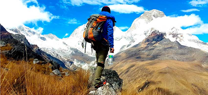
Cusco is located in the Andes Mountains of Peru. A set of mountains adorn its landscapes. The highest peaks are snowcapped difficult to climb. During the Inca Trail to Machu Picchu, the snowy mountains of Salkantay, Verónica or Sahuasiray are visible. In addition, throughout the entire Cusco region it is possible to appreciate beautiful snow-capped peaks. Know what they are, their altitude and how to visit them.
During the Inca Trail it is possible to see the snowy Salkantay in the distance. However, to appreciate it up close it is better to do the famous ‘Salkantay trek of 5 days’. This hiking route reaches its highest point in the ‘Abra Salkantay’ (at 4,650 meters above sea level). This hiking trail covers 70 kilometers in total. The final destination is nothing less than the Inca citadel of Machu Picchu. Unlike the Inca Trail, the tour can be purchased only weeks or days in advance.
Visible snowfalls on the Inca Trail
The Inca Trail crosses sections of the slopes of the mountains that make up part of the Cordillera de Vilcabamba. The most visible is the Salkantay (the second highest in all of Cusco), which can be seen even from Machu Picchu.
The snowy Verónica and the Sihuasiray are only distinguishable at the beginning of the walk, that is, in the geography of the Sacred Valley of the Incas. Both peaks are best appreciated in the rainy season, that is, from November to April.
- Salkantay – Altitude: 6,650 m.a.s.l.
- Verónica – Altitude: 5,800 m.a.s.l.
- Sihuasiray – Altitude: 5,720 m.a.s.l.
Snowy in Cusco
The Cusco region has more than thirty peaks of imposing shape and difficult access. These can be divided into the Urubamba, Vilcabamba and Vilcanota mountain ranges.
The highest peak is Ausangate, which reaches 6,372 meters above sea level (the fifth highest in all of Peru). It is followed in size by the Salkantay, located at 6,271 meters above sea level. Both can be scaled with the necessary professional equipment.
The safest way to visit the Salkantay is by doing the Salkantay trek to Machu Picchu. In the same way, the best way to visit Ausangate is by doing the Ausangate trek.
Urubamba mountain range
It is the extension of the eastern chain of the central Andes. It is located on the right bank of the Vilcanota or Urubamba river, 40 kilometers northeast of the city of Cusco, in the Sacred Valley of the Incas. It covers the provinces of Urubamba, Calca and la Convencion. It reaches a length of up to 750 kilometers. The main snow-capped mountains of this mountain range are:
- Halancoma – 5,367 m.a.s.l.
- Verónica – 5,800 m.a.s.l.
- Sahuasiray – 5,720 m.a.s.l.
- Chicón – 5,530 m.a.s.l.
- Sunchubamba – 5,450 m.a.s.l.
- Terijuay – 5,330 m.a.s.l.
- Pumahuanca – 5,300 m.a.s.l.
Vilcabamba mountain range
It is located northeast of the city of Cusco, between the banks of the Apurímac and Urubamba rivers. It is characterized by deep canyons with a puna landscape. On its slopes the Incas built important citadels such as Vilcabamba and Machu Picchu. It covers a length of 260 kilometers in length. Its main snow-capped mountains are:
- Salkantay – 6,271 m.a.s.l.
- Pumasillo – 5,991 m.a.s.l.
- Lasunayoc – 6,000 m.a.s.l.
- Sacsaráyoc – 5,960 m.a.s.l.
- Panta – 5,605 m.a.s.l.
- Huayanay – 5,400 m.a.s.l.
- Ampay – 5,235 m.a.s.l.
- Soray – 5,428 m.a.s.l.
- Humantay – 5,450 m.a.s.l.
- Padreyoc – 5,771 m.a.s.l.
- Choquetacarpo – 5,500 m.a.s.l.
- Camballa – 5,400 m.a.s.l.
- Palcay – 5,400 m.a.s.l.
- Pucapuca – 5,400 m.a.s.l.
- Chaupimayo – 5,300 m.a.s.l.
Vilcanota mountain range
This set of mountains makes up the second snowiest landscape in all of Peru, as there are up to 469 glaciers there. It borders the city of Cusco and is a section of the eastern chain of the central platforms. It reaches a length of 120 kilometers, which include the Puno region. On its slopes, the rearing of llamas and alpacas is common. One of its most famous tourist attractions is the Rainbow Mountain (Vinicunca). Its main snow-capped mountains are:
- Ausangate – 6,372 m.a.s.l.
- Callangate – 6,110 m.a.s.l.
- Colquecruz – 6,111 m.a.s.l.
- Hatunhuma – 6,094 m.a.s.l.
- Yayamari – 6,049 m.a.s.l.
- Chumpe – 6,106 m.a.s.l.
- Alcamarinayoc – 6,102 m.a.s.l.
- Pachanta – 5,960 m.a.s.l.
- Huilaje – 5,900 m.a.s.l.
- Yapu Punta – 5,852 m.a.s.l.
Tips for your visit to the snowy mountains of Cusco
Either on the Inca Trail or the Salkantay trek, the walks near immense snow-capped mountains can cause the so-called ‘altitude sickness’. The most common symptoms are: fatigue, nausea, and headache. To reduce them, it is advisable to spend 1 or 2 nights in the city of Cusco before starting the walk. Thus the tourist’s organism will better adapt to the new mountainous geography.
The 4-day Lares trek is another of the hiking routes in Cusco that offers snowy landscapes of great beauty. During this 32-kilometer hike, you can see the snow-capped Pumahuanca, Capacsaya, Chicón and the immense Sihuasiray. It is also possible to know several enclave lagoons near the high snow-capped mountains. On the penultimate day of the tour, you will arrive in Aguas Calientes by train to visit Machu Picchu on the last day.

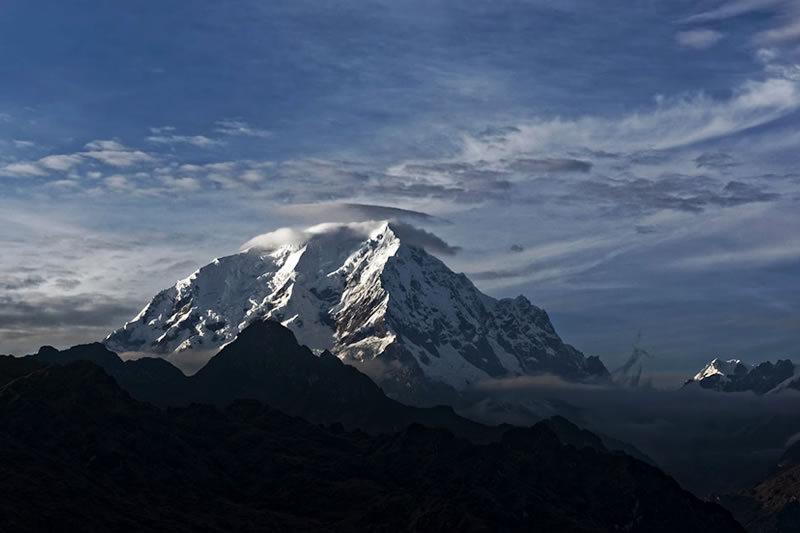
Sunrise at Nevado Salkantay
By Inca Trail Machu Picchu - Last updated, 22-08-2024
Interested in the Inca Trail? Know more about Nature!
- Coca leaf, ideal for trekking in Peru
- The Cantuta flower. Where to find it on the Inca Trail?
- Fauna of the Inca Trail
- Spectacled bear on the Inca Trail to Machu Picchu
- The cock of the rocks on the Inca Trail
- Inca Trail: butterfly observatory
